Royal Park Wetland, Trim Warren Tam-boore
Location \ Royal Park, Parkville, Melbourne
Client \ City of Melbourne
Consultants \ Ecological Engineering
Royal Park (Trim Warren Tam-boore) is central Melbourne’s largest inner city parks; its size, location and design make a significant contribution to Melbourne’s garden character, sporting heritage and its Victorian legacy. The original 1984 design of the park was intended to evoke a sense of the landscape at the time of European’s first encounter with the site and called for extensive planting of indigenous trees and native grasses. This philosophy is still evident today and the park has played in important role in ensuring indigenous flora and fauna habitat are retained in the city.
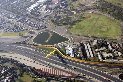
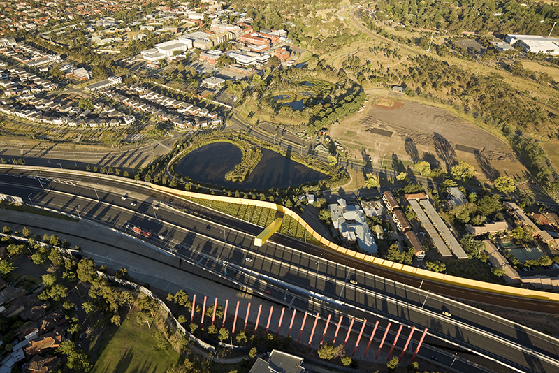
In 1998, The City of Melbourne adopted the Royal Park Masterplan which included the development of a wetland system for storm water recycling and harvesting as a key component. In collaboration with Ecological Engineering, rush\wright associates developed the design and landscape masterplan for the wetlands and surrounding open space at the western edge of the park. This work was completed for the commencement of the XVIII Commonwealth Games and the wetlands were officially opened on in June 2006 as Trin Warren Tam-boore (Bellbird waterhole).
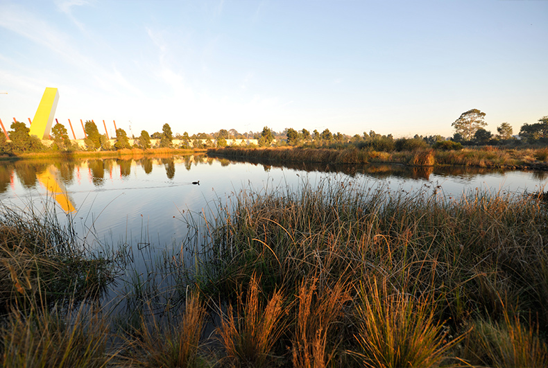
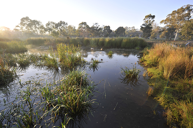
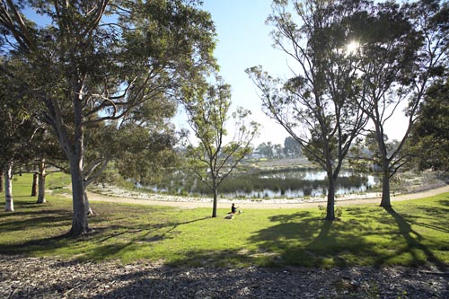
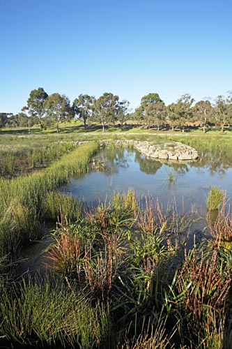
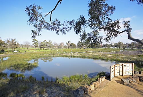
The project is significant as an innovative combination of engineering, ecology and community engagement which has created a unique landscape and water management outcome in a high profile city park. The wetlands system consists of two linked ponds that provide natural water quality treatment and the storage of treated stormwater captured from the park and its surrounding catchment. Recycled water is then used for irrigation in Royal Park with excess clean water discharged to Moonee Ponds Creek and Port Phillip Bay. The treatment wetland and its adjoining landscape is intended to create an artificial billabong environment, focusing on providing educational, interpretive and passive recreation opportunities focused on environmental understanding. The storage wetland provides an open water lagoon from which water is sourced for irrigation of the parklands.
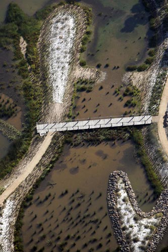
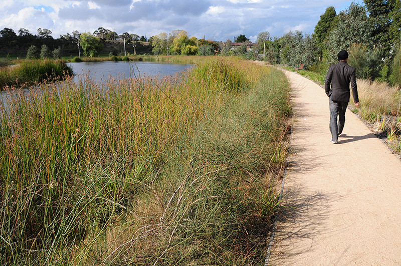
From above, the form of the wetlands are deliberately abstract, biomorphic motifs which make reference to the work of the land artists like Smithson and are unapologetic in their function as infrastructure. At ground level the visitor experiences something much more subtle, more like what Hargreaves describes as the fuzzy edge. Peninsulas extend into the wetland to define the serpentine flow of water from the inlet pond, through deep and shallow marshes to the outlet pond. Boardwalks enable close access to the wetland environment and connect with an informal path system to provide a varying experience of the vegetation types and wetland ecology. The treatment pond forms the heart of a community-planted native habitat area, with a perimeter path and boardwalk providing a range of education and leisure experiences.
‘Constructed Ecology’ – designing landscapes as environmental processes, with a systemic ability to have real ecological value which is capable of being observed by users, is central to rush\wright’s practice. At every stage of the project, the major focus was to improve environmental outcomes by producing two hectares of aquatic habitat that significantly increases biodiversity in the area, reduces potable water used on the parklands and ensures that cleaner water reaches the bay. The resulting landscape delivers this along with an environment which is diverse and delightful oasis within the city.
Recipient of the 2008 AILA Award for Land Management.